My vaulted ceiling window in the Guam Business Motel looks out directly onto the road. It’s not a super busy road (is there such a thing in Guam?). But I can hear traffic whizzing past at all hours of the night. And whether they’re wild or domesticated (there IS a KFC not too far from me), there’s a raft of roosters that crow as the dawn’s early light gathers itself. Having tossed and turned in a jetlagged and general off-kilter haze, I decided to get up and go for a run. I had hoped to avoid the heat of the day by starting with the roosters.
The best laid plans.
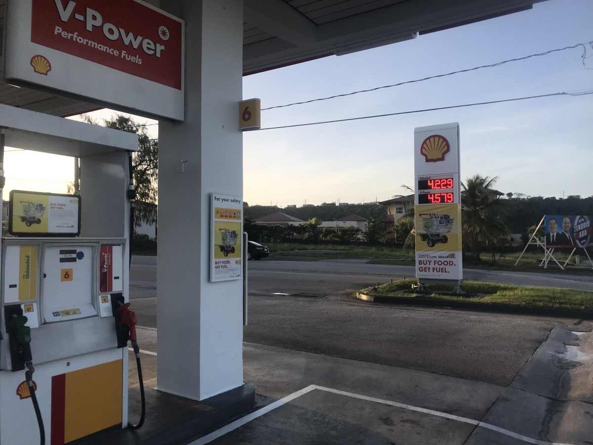
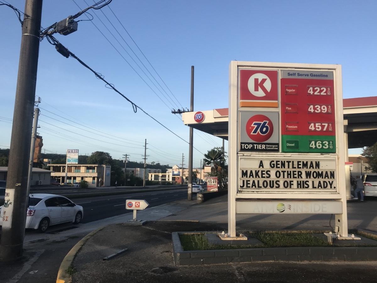
It was a slow, hot, humid run… even if it was ten or twenty degrees cooler than it would be later in the day. I struggled. A lot. More of the same. But I did manage to snap a few photos along the route — I’ve been meaning to document that every gas station on the island charges the same amount — $4.229 for a gallon. Doesn’t matter which company, where you are on the island, or cash or credit. There isn’t a penny’s variation… and in some cases, the pithy sayings posted on their boards are uniform.

The 76 stations across the island yesterday for example all proclaimed “A well read woman is a dangerous creature.” Today there was one for the guys…
Huffing and puffing along, I passed a couple of schools — JFK High had a mural saying “Ask Not What Your Island Can Do For You….” But I was much more taken with THIS school’s sign:
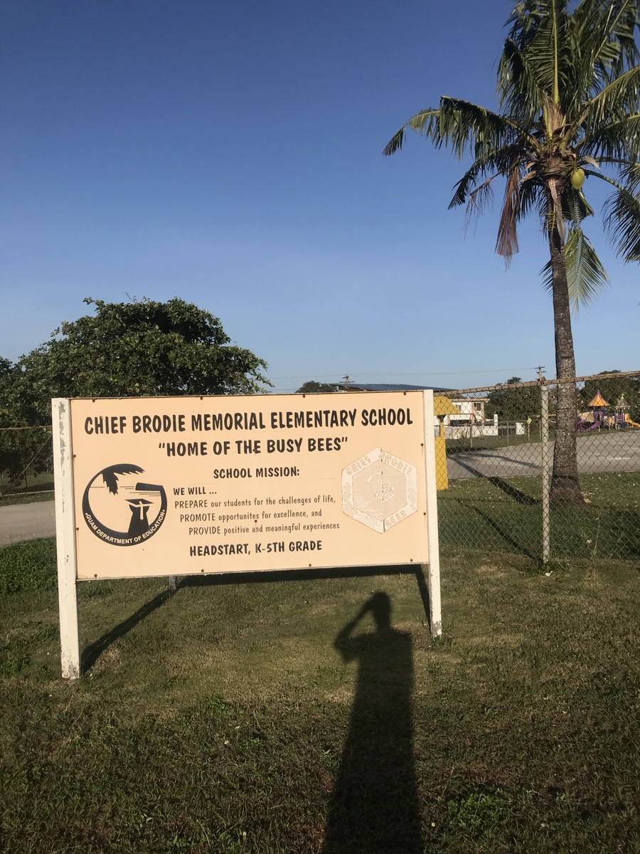
The busy bees is a terrible team mascot. And how in the name of Steven Spielberg aren’t they the Chief Brodie Sharks? I mean, come on!
***
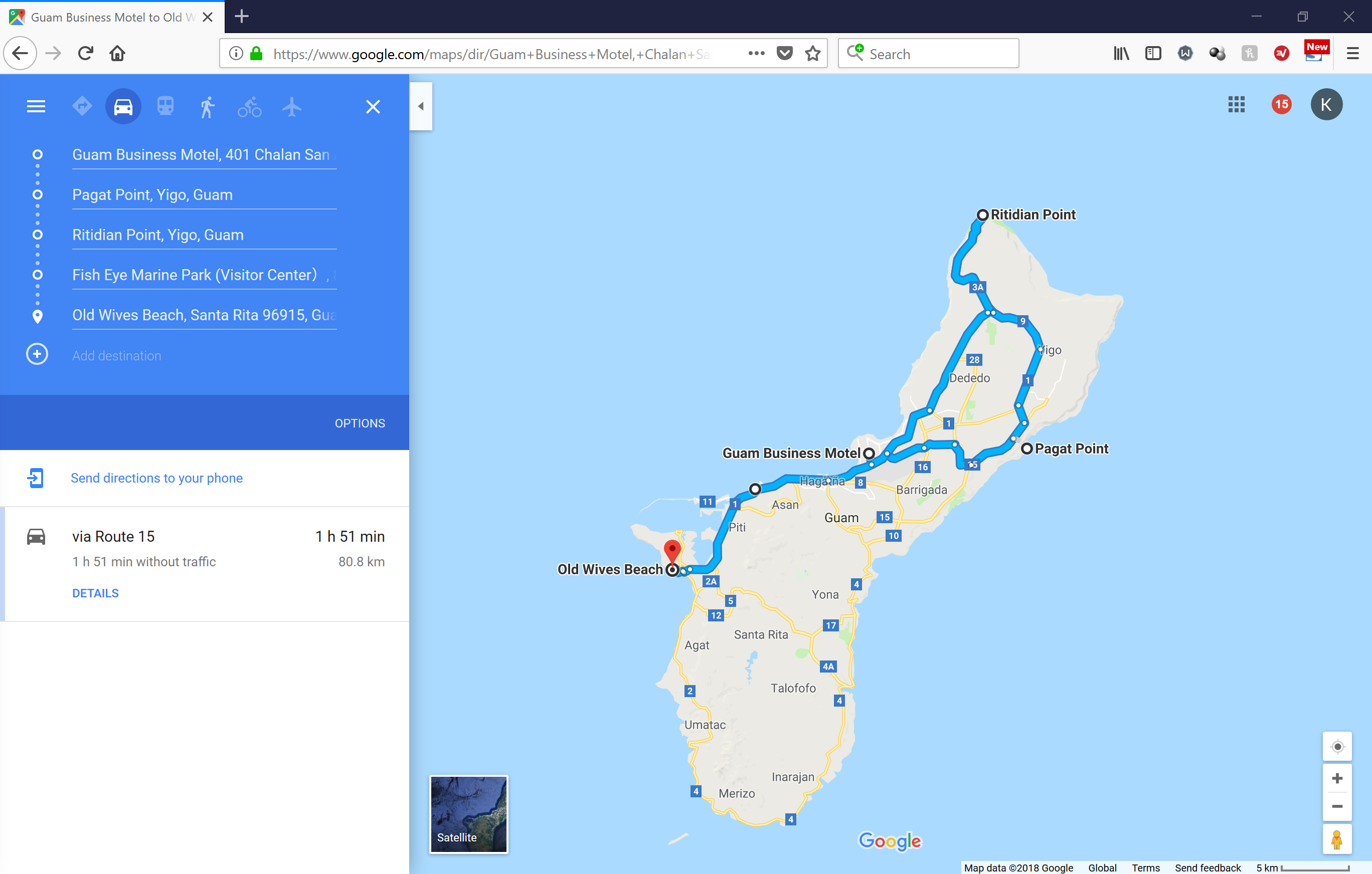
So this is a map of what one could do to go all the way around Guam on a road trip:
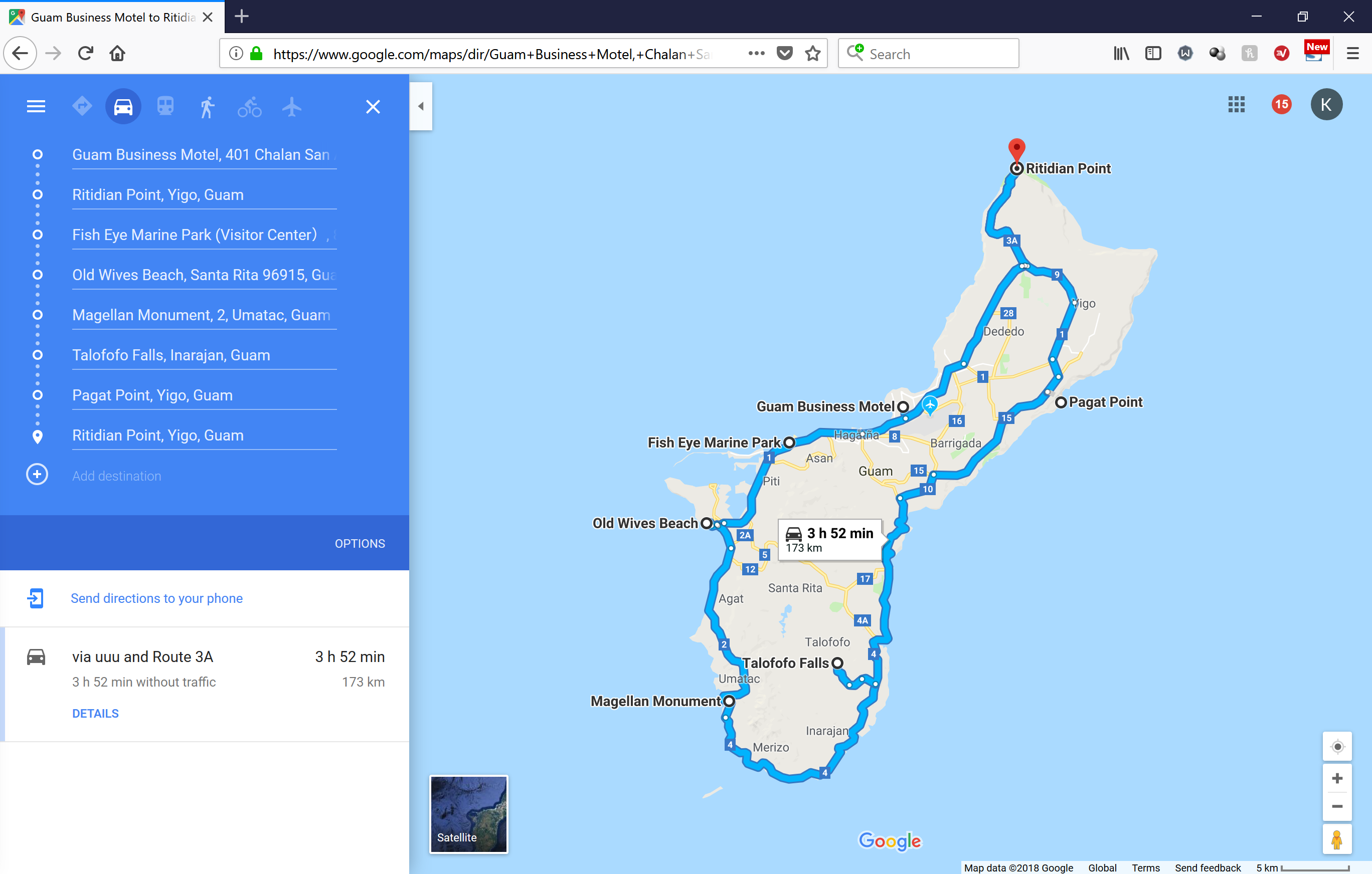
I’ve already done some of those places so I decided to rethink my plan via a hastily scribbled itinerary on yet another local eatery’s serviette.
My plan was to hit:
- Pagat Point
- Ritidian Point
- The Fish Eye Marina Park
- … and to close out the day by lounging around at the Old Wives Beach.
That last one just felt like a name I should check out.
So I plotted a course for adventure via GoogleMaps. Little did I realize just what sort of misadventure lay in store.
In driving to Pagat Point, Google directed me out and about and as the dulcet tones rang out from my phone, I knew I was approaching my destination… except when I “arrived” I was literally in the middle of a four lane highway. I guess I could’ve parked along the shoulder and bushwhacked out to some place but there certainly wasn’t a sign or a turn out for this thing. I don’t know if Google was just messing with me or if Pagat pulled an Amerigo Vespucci. Amerigo was kinda the Donald Trump of cartographers back in the day. Just throwing his name on a land mass and claiming it as, ya know, “America the Beautiful.”
As I was near Anderson Air Force Base I couldn’t tell whether or not I was okay to stop… so I opted to continue my journey and view the Pagat Point as seen as Brigadoon. Oh, sure. There are photos online. But then so are photos of men landing on the moon. “As if that could happen,” my conspiracy theory friend would say.
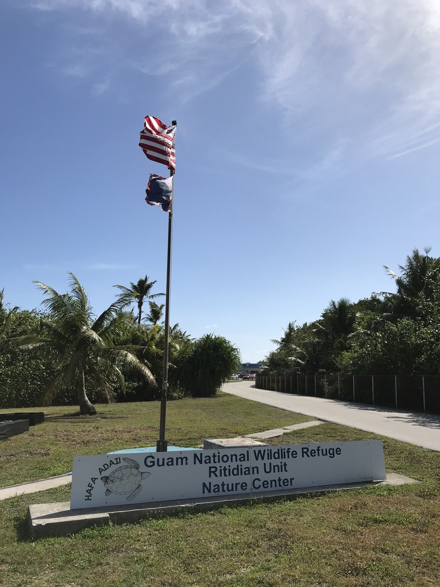
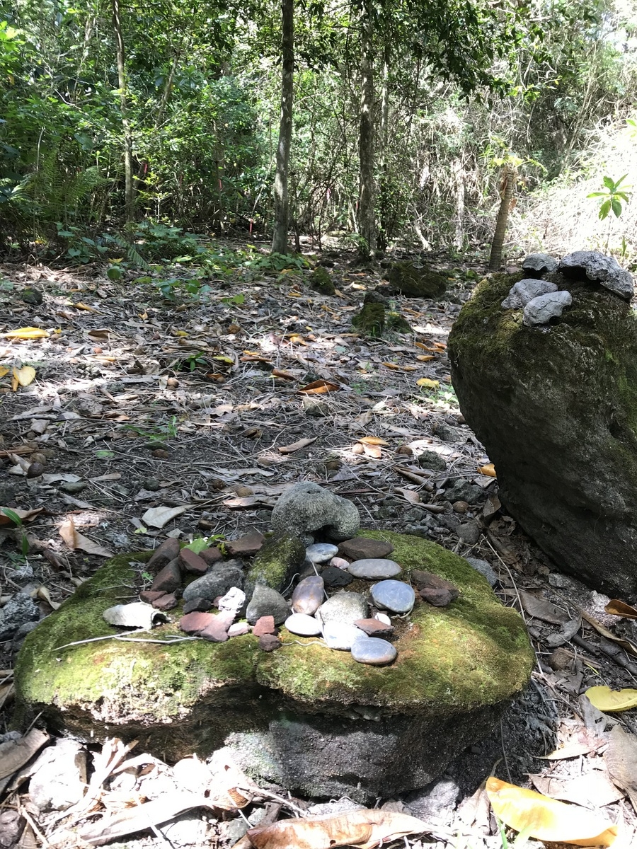
Ritidian Point is located amidst the aforementioned AFB, nestled in at the Guam National Wildlife Refuge. It offers a protected preserve for local flora and fauna, as well as being the site of various archeological digs for Marianas Islander history. It also is under investigation for unexploded ordinance and all travelers are advised to proceed with caution.
After taking in a scenic view…
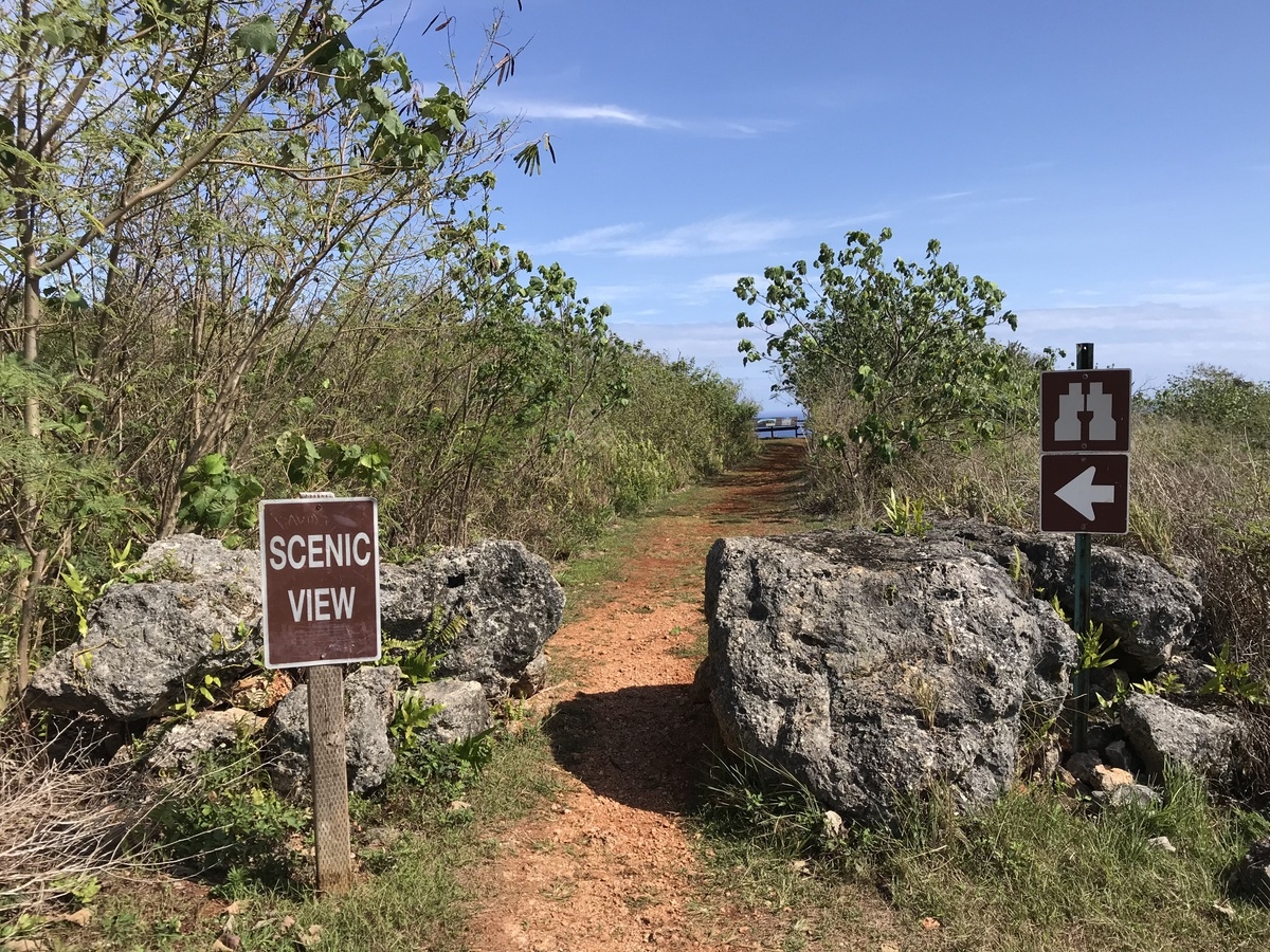
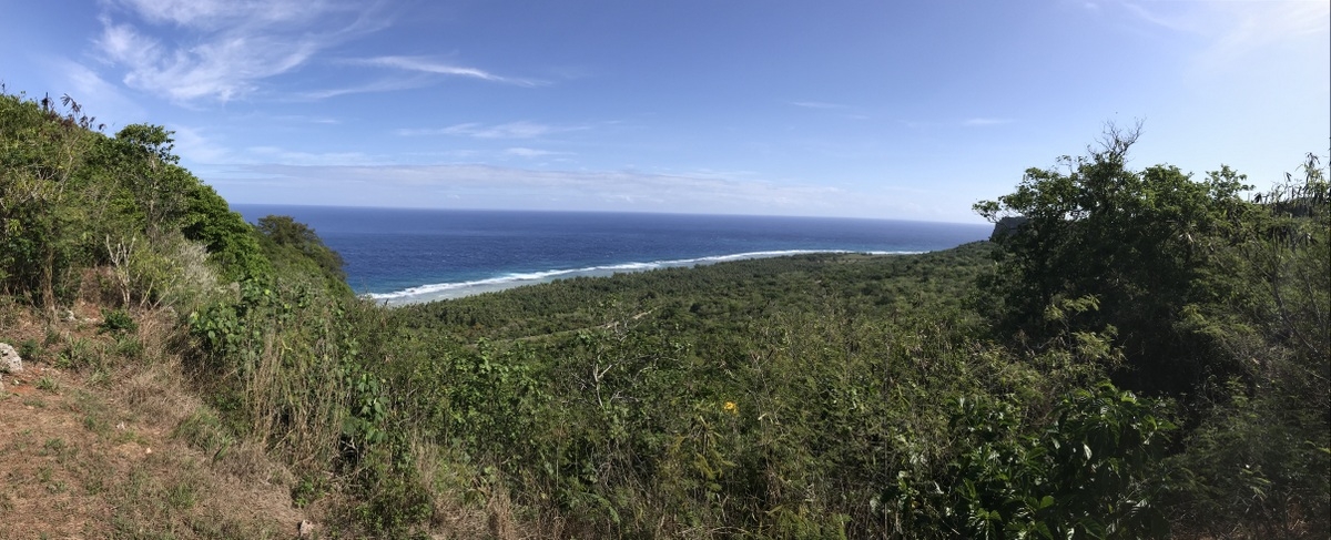
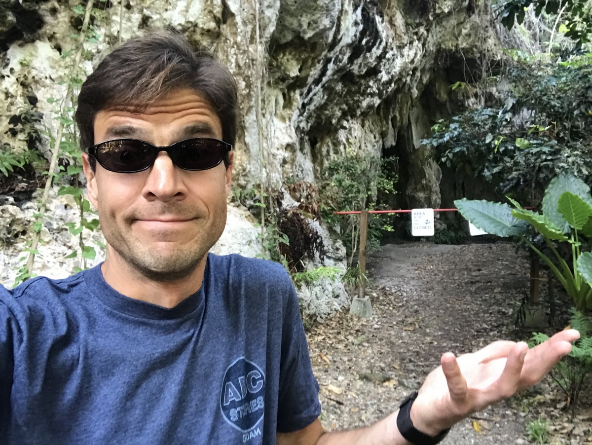
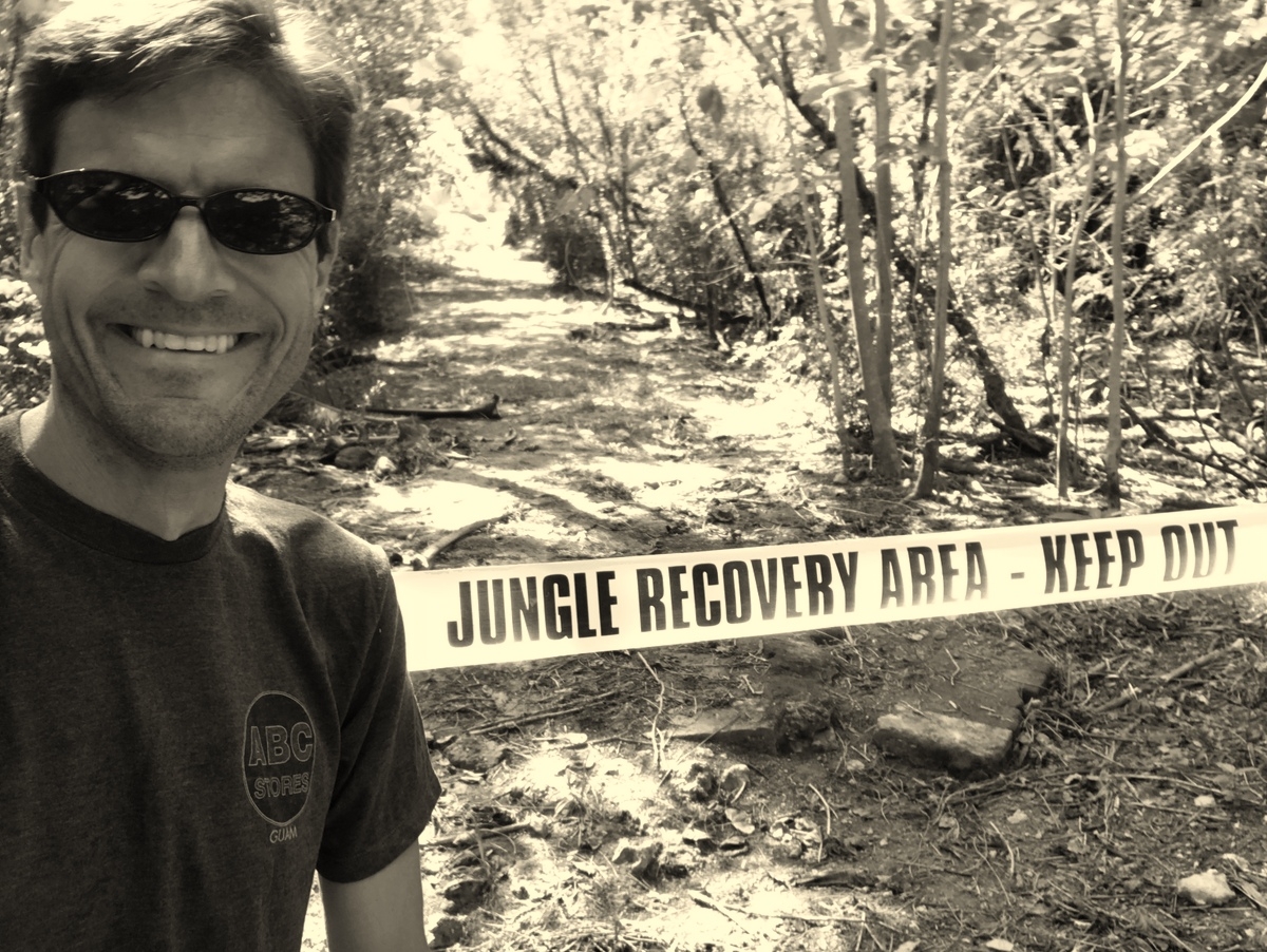
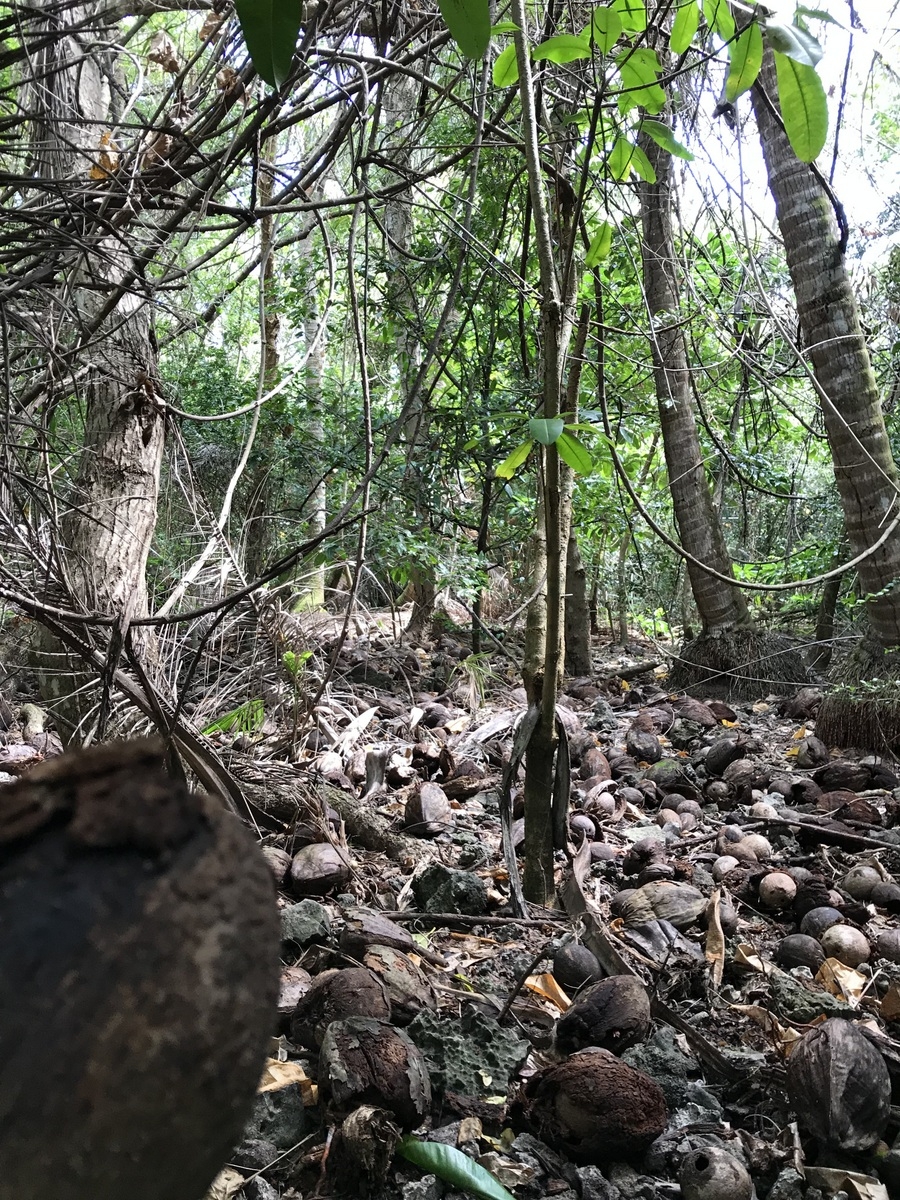
I drove down to the bottom of the hillside and planned on hiking the nature trails to explore the area.
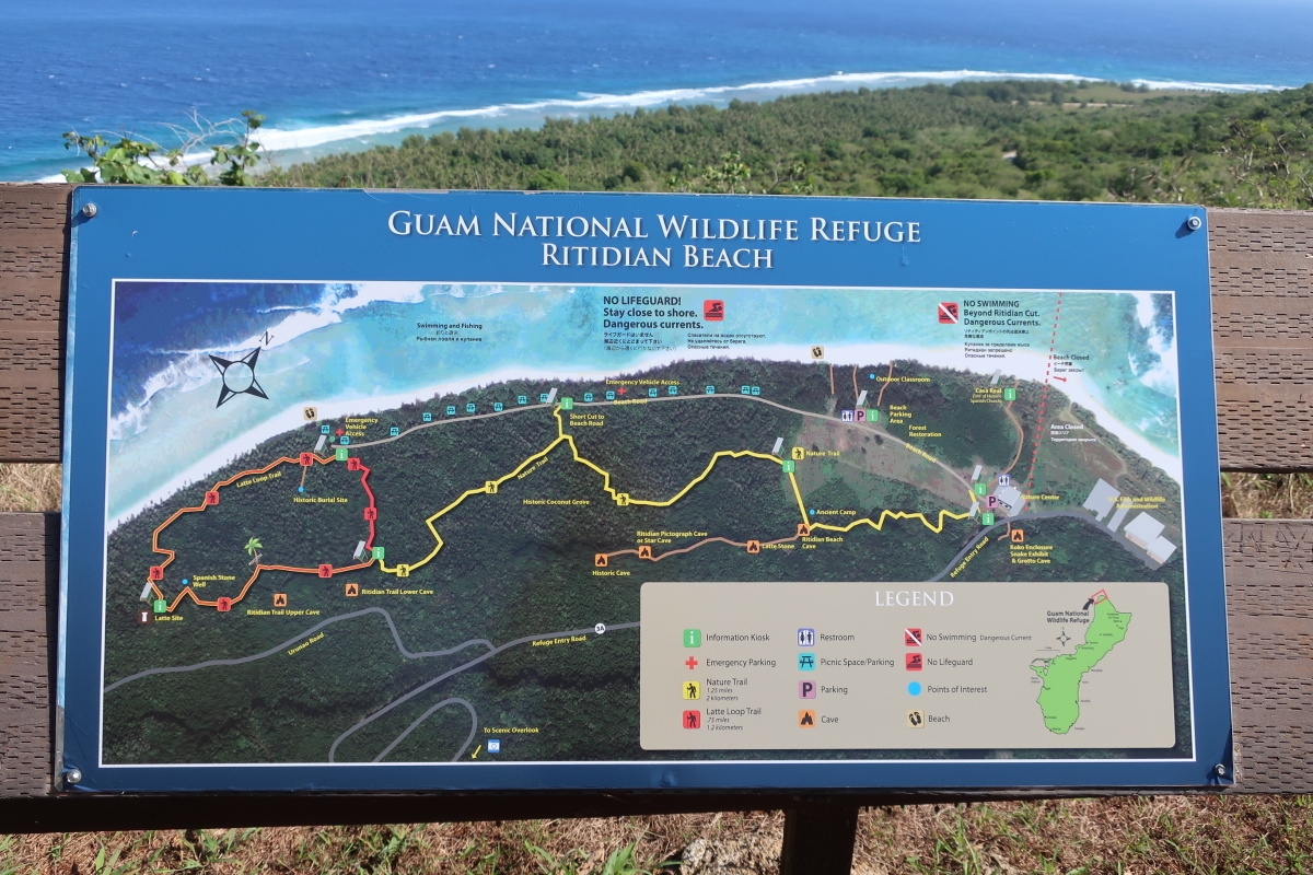
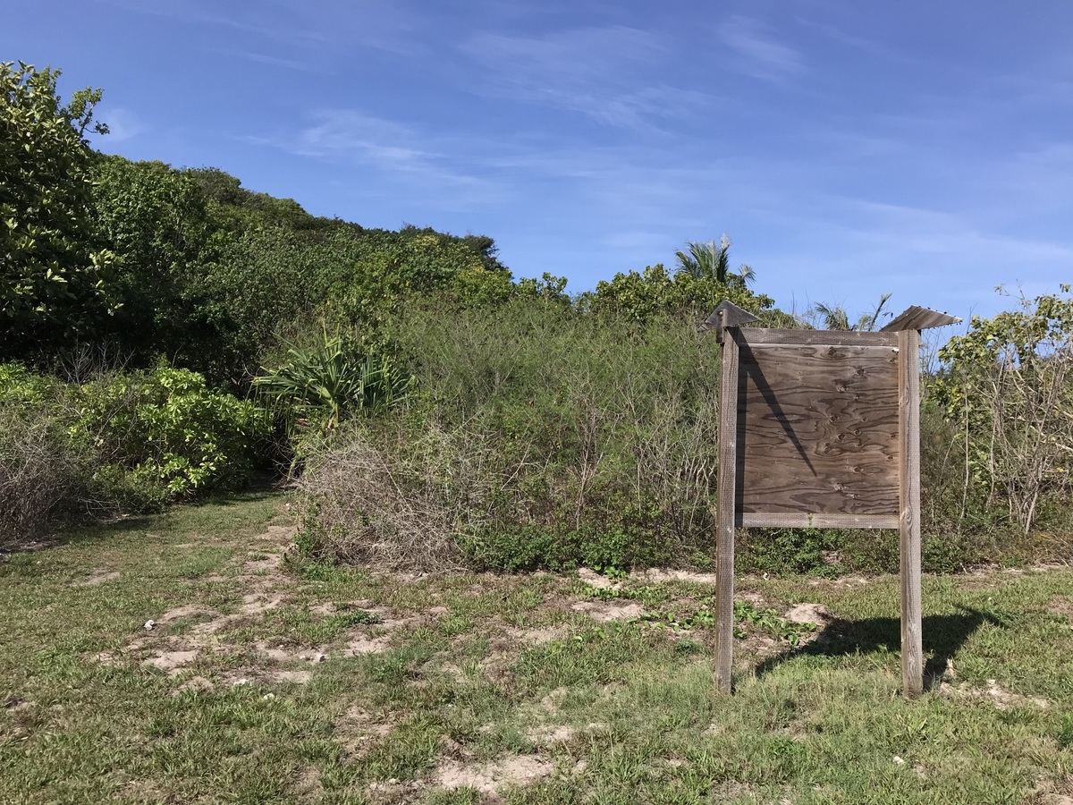
But here’s the thing that map didn’t tell me… nor did the signs along the way as started the first trail:
I hiked the half mile or so to the caves I was looking forward to seeing and was met with this notice:
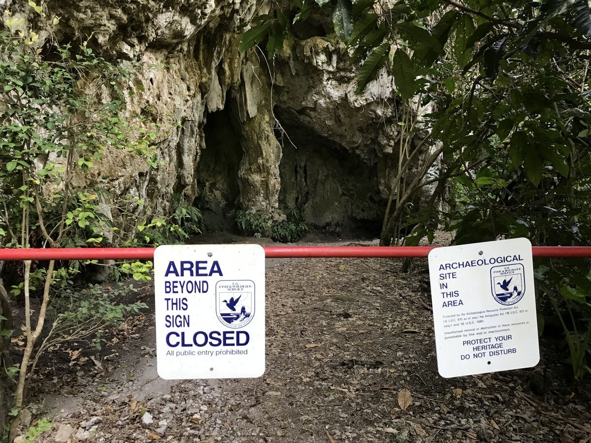
Things I Could Have Been Told BEFORE Hiking A Half Mile Or So for $1000, Alex.
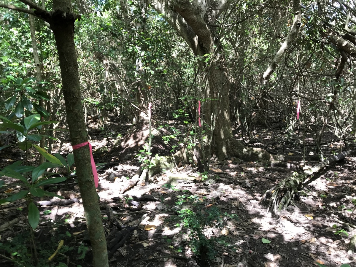
Returning to my car, I ventured further in figuring I could do the second trail loop at least…
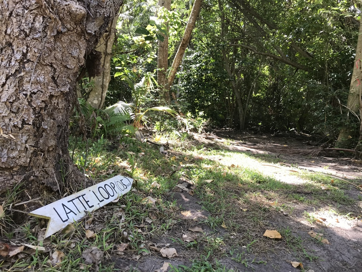
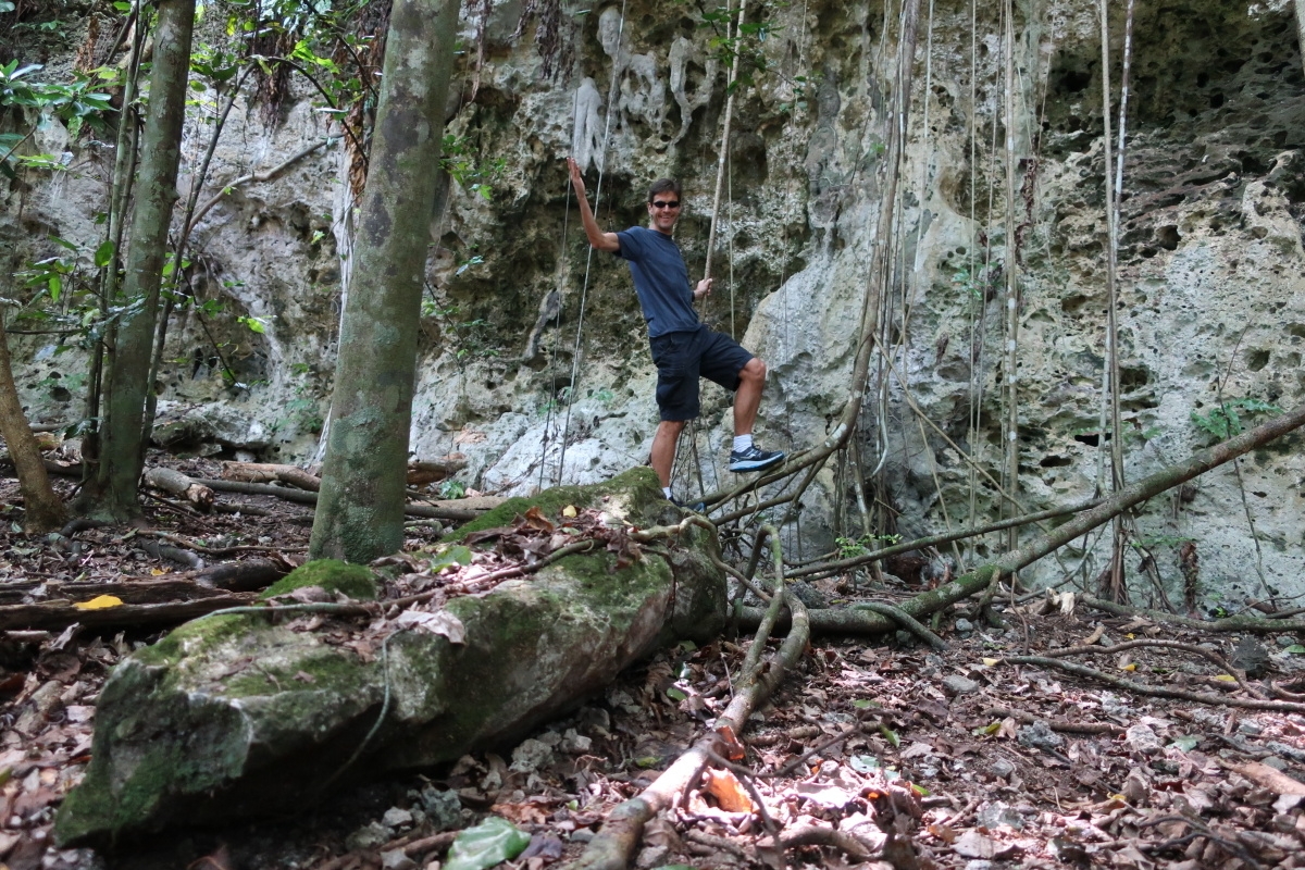
It too wound up dead ending rather than continuing on. I thought those pink ribbons were route markers but in truth I think they were preservation indicators.
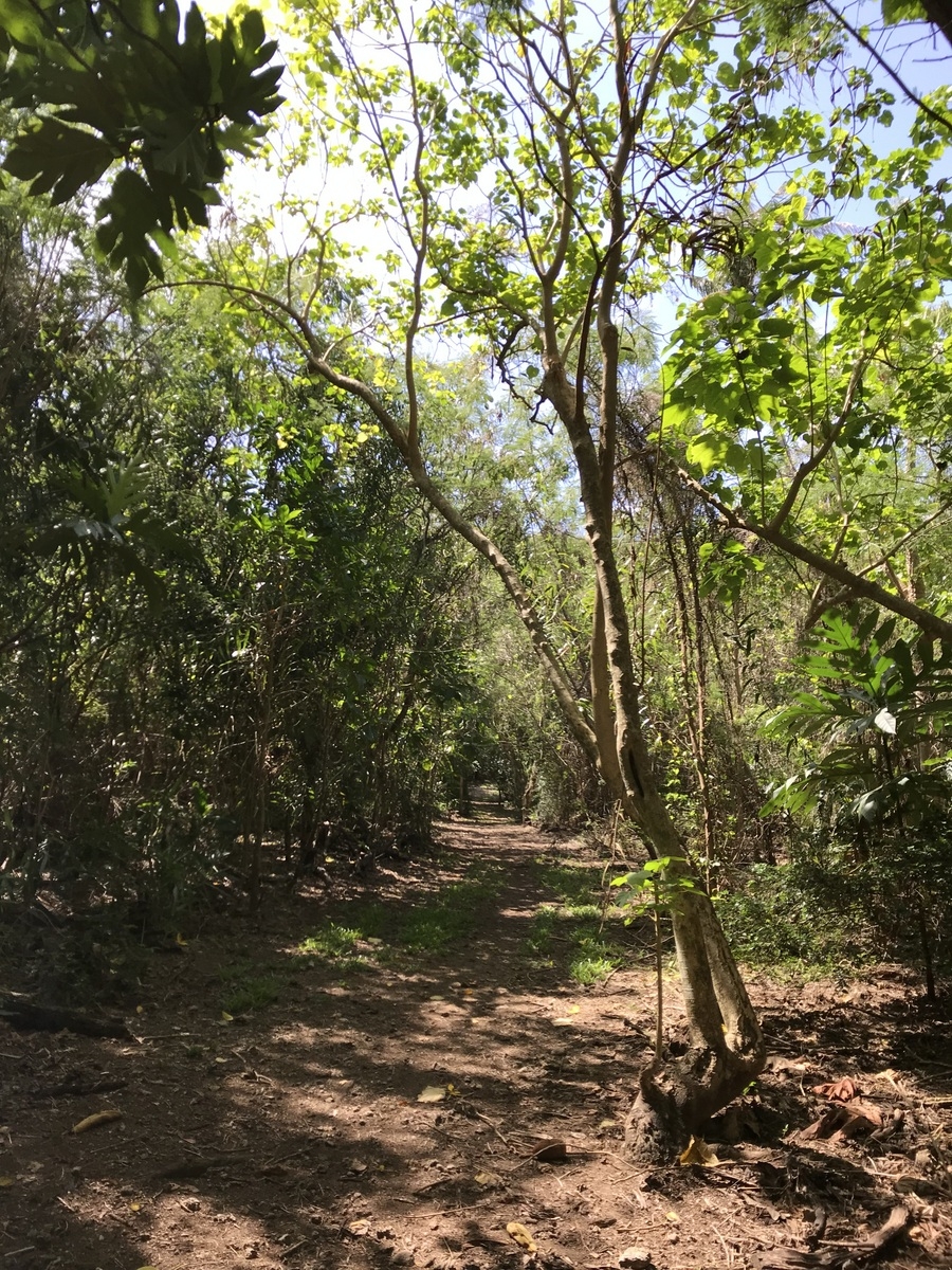
Whatever the case, I decided I should just retrace my steps and head back… except, that’s not quite what happened.
Here I am sunburnt and Lost In Guam:
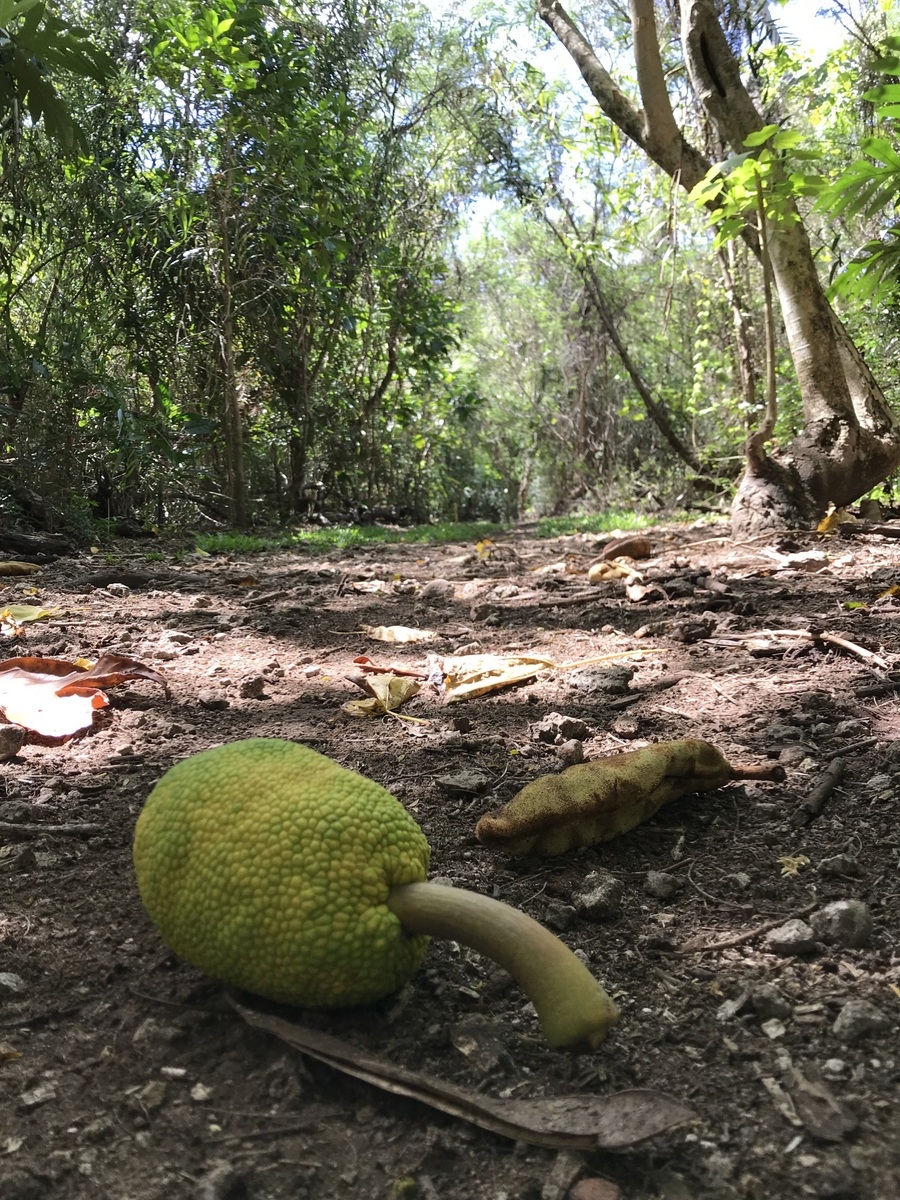
On the plus side, I finally got back on the trail and was able to shot this time lapse video returning me to where I’d parked.
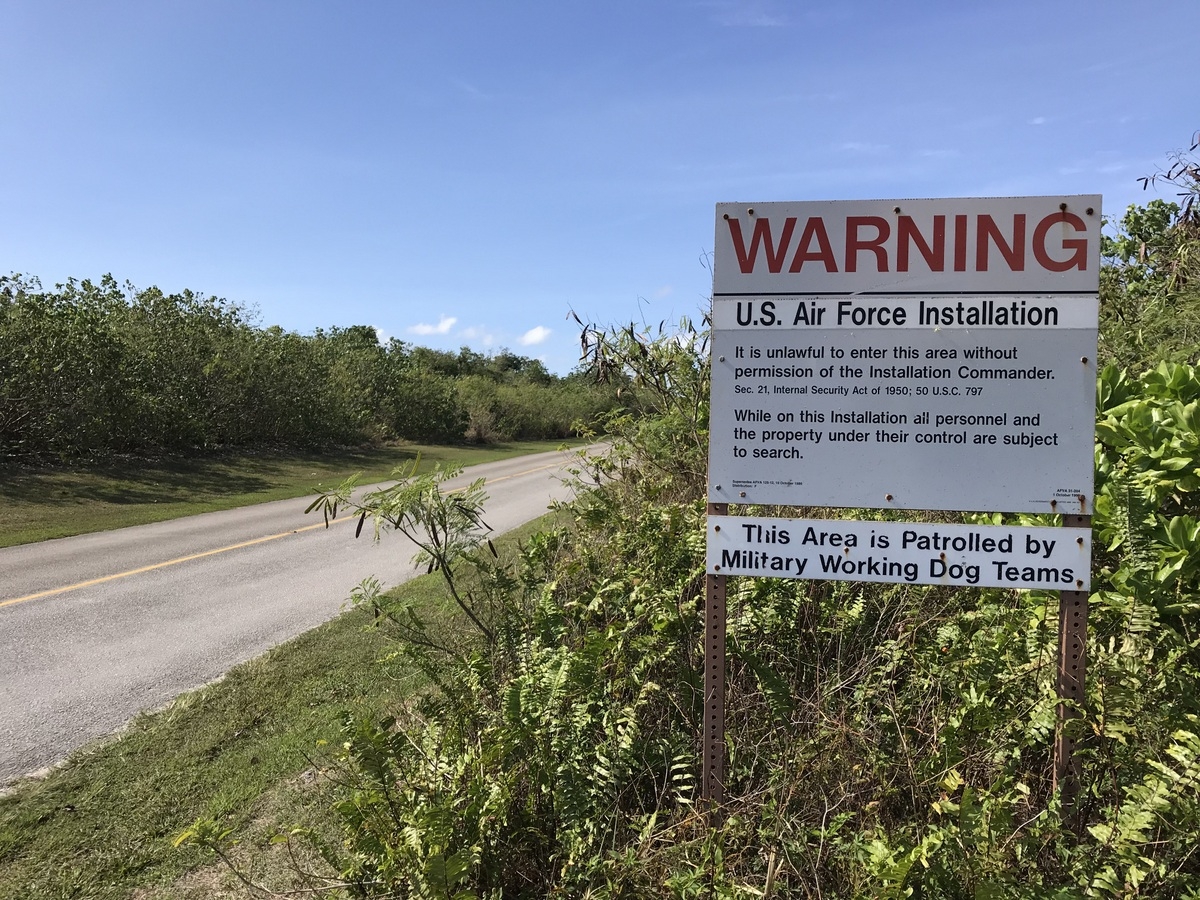
It was getting on to noon and I had skipped breakfast so I thought I’d try this local Charmorro place that, while a bit off the beaten path, was hailed as being pretty great. Figuring I’d already been off the beaten path this day, why not, right? I did however stop at an Air Force Base warning sign that cracked me up. I could only picture Elmer Fudd stalking the jungle…
***
I got turned around on my google map and I was on the lower side of the mountain and needed to be on the upper tier. There are only so many roads that get up and down and so I had to backtrack quite a bit to find the way back up. But, no, I thought. It’ll be worth it. People said this place was good. Chesa Guam was reasonably priced and had what I wanted…
And yet. Despite my best efforts I was repeatedly detoured round and round several more times because Google couldn’t decided where things were spatially on the island (don’t ever bother asking me for directions — I always assume the way I’m facing is North because isn’t that how a compass works?). Anyway, I finally get there… and I don’t necessarily blame Google for this… at least not entirely… but shouldn’t they know these things… they’re GOOGLE for crying out loud… but Chesa Guam is temporarily closed due to an electrical issue. I wasn’t alone at least — there were about five or six cars pulling excitedly into the tiny lot only to despondently drive past the handmade CLOSED sign and slowly roll back into the street. Phooey.
As my stomach growled like the world’s dumbest bear craving a jar of honey, I figured I had to eat something. I went with a place nearby that I had rejected as being too pricey (a few places on the island, like this one, charge a 10% service fee on top of their menu prices… I always have hated that nonsense. It’s not a sales tax as there’s no sales tax here in Guam… it’s just a service charge). The shrimp patty burger I had was pretty good… but it was a pricier lunch than I would have liked.
Feeling both rejuvenated by food and dismayed by costs, I checked my napkin and saw I was slated to hit the Fish Eye Marina Park next. It wasn’t too far down the road…
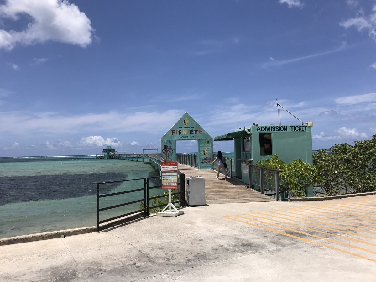
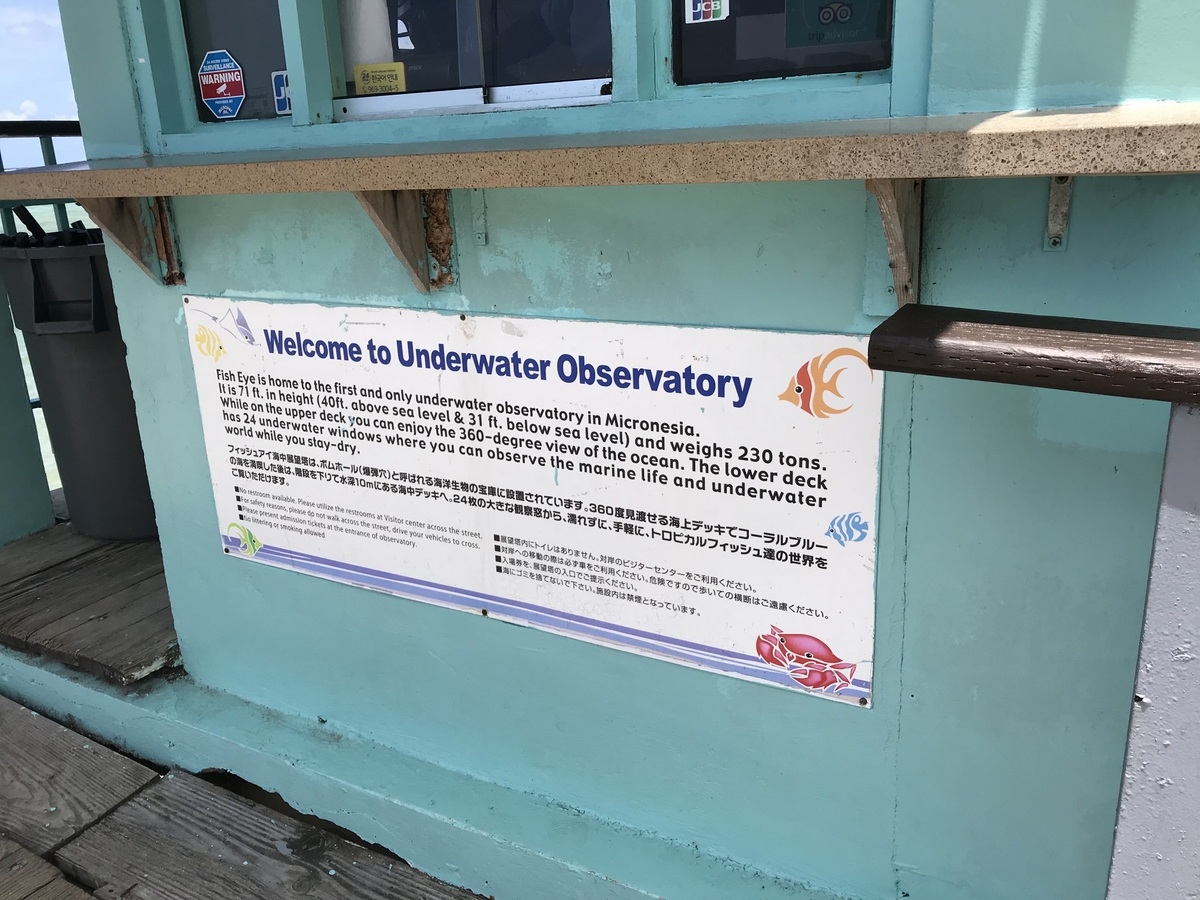
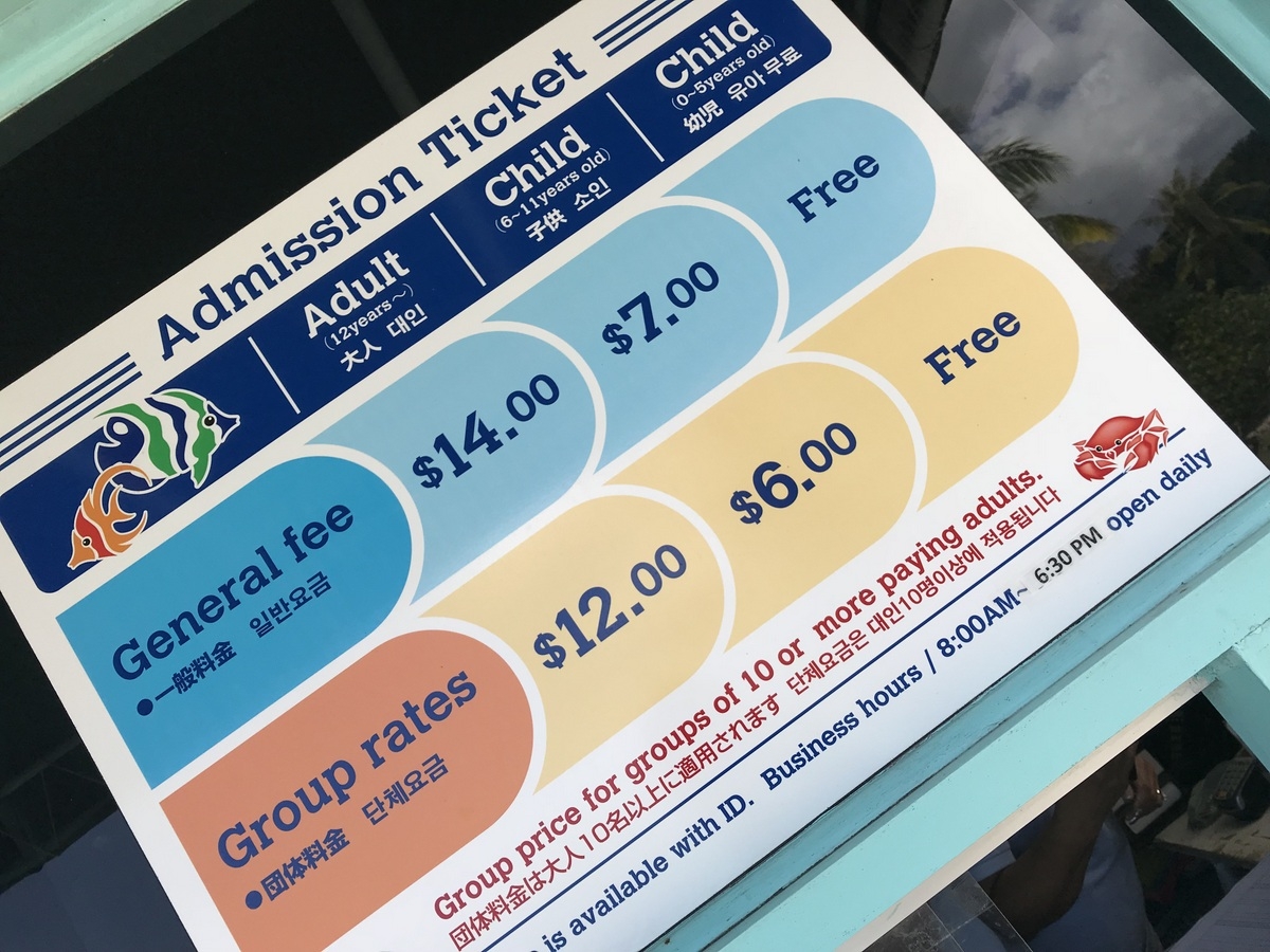
Now here’s the thing. I thought $14 was a bit much as it was but I was prepared to suck it up for the experience. But the cashier at the ticket counter was too engrossed counting the cash from the till. I stood there for a minute or two and she slid open her plexiglass window to tell me she’d be with me in a moment. And I get it — she’s counting the money and securing it. But after about five minutes more of waiting, I had a Kenny Rogers moment. You don’t your money when there’s customers waiting to see the fish. There’ll be time enough for counting when the observing’s done. After a few more minutes and a pushy Japanese couple muscled past me to knock on the window and she sold them a ticket, I knew it was time to not hold ’em, I knew when to fold ’em, knew when to walk away and when to run.
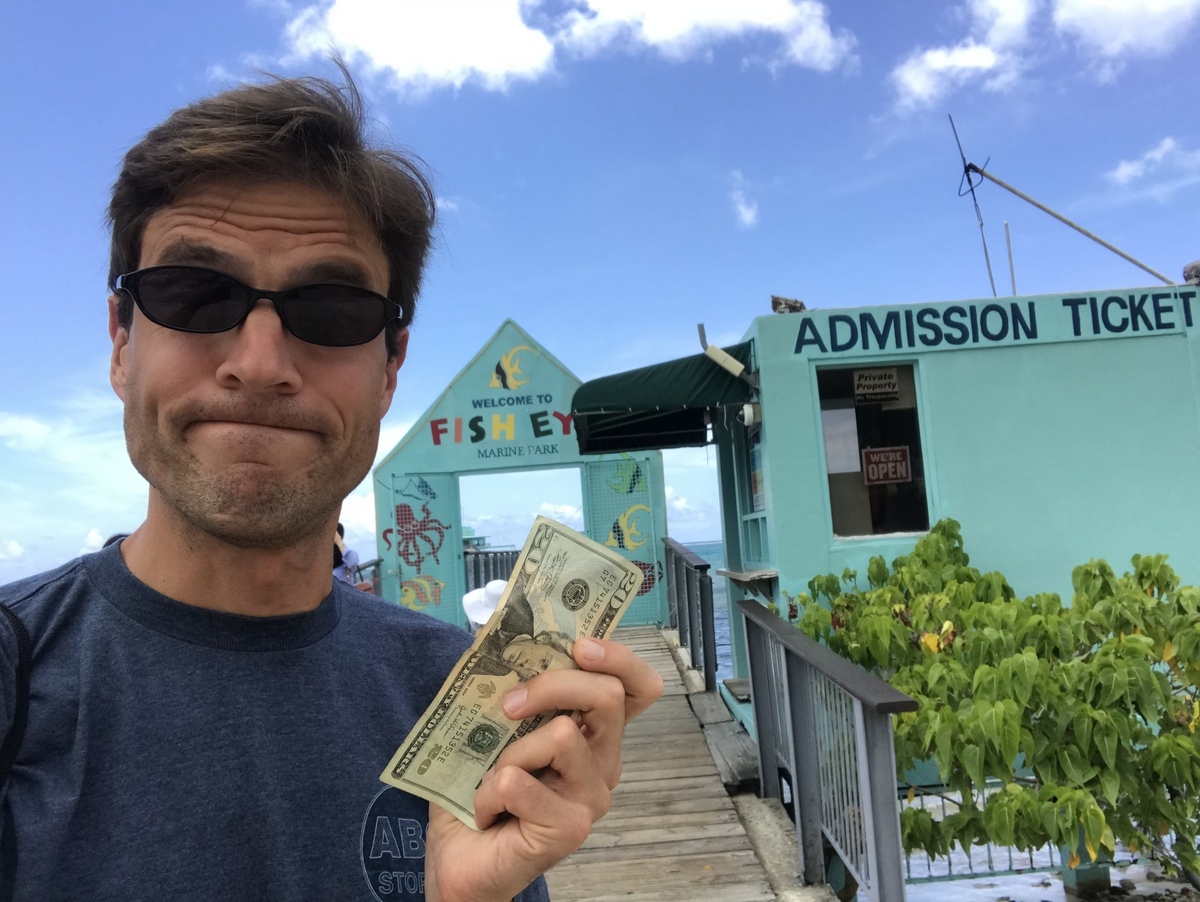
So I kept my $14 and skipped it. And I know what you’re thinking — that’s a twenty dollar bill in my hand. Steven Mnuchin hasn’t yet issued the fourteen dollar bill. I assume Ivanka will be on it. Oh, who am I kidding? Of course it’ll be DJT’s portrait on that thing.
I vowed to wander over to Epcot’s Living Seas the next time I was home and see the fish that way.
Yeah, yeah. I know. It’s called The Seas with Nemo and Friends. But I’m an old man and stuck in my ways.
***
The last stop for the day was going to be Old Wives Beach. I stopped and bought a bottle of water and I grabbed my kindle, preparing to sit on the beach and read. And if my Myanmar fortune teller was right, I might just meet my true love while traveling this year. Let’s be honest, at this stage in the game I need a divorcee who has lowered her sights and is looking to settle. But there wasn’t a Divorcee Beach listed anywhere.
Turns out Google Maps knew where the beach was and kept telling me where to go. Except it was on US Government Property, i.e. within the OTHER military base on the island, Naval Base Guam. While I might have low level security clearances from a couple of marathons I’ve done at military sites, somehow I couldn’t see talking my way past the MP so I could lounge on Old Wives Beach… even though Google Maps was telling me I just had to drive another 1.5 km.
Does Google Maps vouch for my security clearance? Could I have shown my phone and said, “thanks, officer… just passing through!” I don’t know. If only there was some way to search an information resource and get an answer to that question. But that seems impossible.
Maybe you can go on the base to hang out at the beach. I chickened out and wound up making a U turn and spending a few chapters reading at Apaca Point, a beach I was able to pull up at.
I feel like I’ve kinda exhausted my driving and Guam experiences at the moment. I’m sure there’s other things to see and do (I’m not a Scuba diver or snorkeler so that’s a wide swath of activities I’ve just written off). I’m not going to parachute or get a tattoo. But I might spend a bit of time on the beach tomorrow reading a book.
In the meantime, let’s close with a moment of Zen at Apaca Point: